Cefnllys
Welcome to the beautiful mid Wales area where there are many walks short and long available. See below for a small selection to help you get started. Good footwear recommended and outdoor weatherproof clothing essential in the winter months and wet weather! If you like to explore, OS Explorer map 200 which covers our immediate area and the Elan Valley will be useful.
Please ask if you need further guidance on any of the following suggestions.
IMPORTANT NOTE: any service and amenity information provided here is for guidance only. We recommend that you make direct contact with any service or amenity provider to confirm availability before travelling.
Walks from Tynewydd
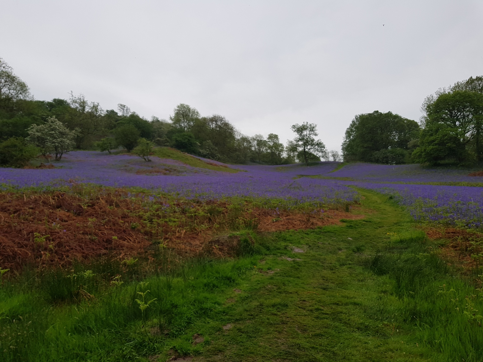
Penybont Common
Penybont Common is a large area of open access common land on the north side of Penybont village only about ten minutes walk from Tynewydd. It provides 1.5km2 of open walking, shared with the sheep, cows, birds and an occasional dog walker! Great views from some of the higher points in fair weather, suitably rough and wild in the winter.
Terrain: fairly rough even in dry weather so stout footwear is advised. In wintry weather you should head out well prepared for terrain that can be very wet and boggy. The A488 and a minor road do cross the area providing some hard surfaces, mainly though the terrain is rougher. There are a couple of bridleways marked and plenty of tracks worn by quad bikes, tractors and sheep.
Time: walk for shorter or longer as you please taking any route you wish.
Shorter: a pleasant short walk keeping away from the rogher terrain is possible up along the right hand edge of the A488 and then off to the right after about half a mile following the bridleway for a short distance. You can walk reasonably easily there and back for half an hour to an hour.
Longer walks can take you anywhere on the common. One suggestion: follow the bridleway to the top road near the Pales for great views back across the common and to Penybont. Continue down to the main A488 road, cross and head to the north most side via the small hill tops, then head west in similar manner before returning to the entrance gate. See link to the rough guide map on plotaroute.com below. Around 90 minutes to 2 hours should be sufficient for this walk.
Map: Penybont Common circular
Penybont Llanbadarn circular
If you prefer a harder road surface to walk on, this is a very pleasant circuit mainly around some of our minor roads.
Terrain: hard road surface all the way. Reasonable walking footwear recommended.
Time: 1.5 to 2 hours.
Map:Penybont Llanbadarn circular
Shaky Bridge and back
Pleasant walk to the popular beauty spot known as Shaky Bridge with a mix of part minor road and part public footpath. The original bridge here across the river Ithon was dangerously shaky hence the name. There is Natural Resource Wales woodland and a picnic site. From here you can explore Bailey Einon Nature Reserve, the grass covered ruins of Cefnllys Castle and the 14th century Church of St Michael. If you prefer you could drive over – there is parking available at the site.
Terrain: some hard surface on minor roads and some public footpath as you approach Shaky Bridge which could be more difficult in places, especially in more wintry weather. Reasonably stout walking footwear recommended.
Time: Around 1-1.5 hours each way. Allow 2-3 hours in total depending on pace, stops and so on.
Map: Shaky Bridge – there and back
Walks – up to 30 minutes drive
Fishpools
Fishpools is a Natural Resources Wales woodland site in the Radnor Forest with walking trails and car parking. For more information about the walks and the area, read more about Fishpools.
Directions from Tynewydd:
Warren Wood and Water-Break-Its-Neck
Warren Wood is a Natural Resources Wales woodland site in the Radnor Forest with walking trails, car parking and featuring the popular Water-Break-Its-Neck waterfall. Read more about Warren Wood.
Directions from Tynewydd:
Abbeycwmhir
Abbeycwmhir is a pretty and historic village situated in the old county of Radnorshire. The village is the site of a ruined abbey, the burial place of Llewelyn the Last Prince of Wales. There are a number of Natural Resources Wales forestry areas nearby with off road parking and miles of forestry tracks to explore the beautiful mid Wales scenery. You can also follow the way marked Glyndwr Way National Trail which runs through Abbeycwmhir.
Directions from Tynewydd:
Elan Valley
Part of the rugged Cambrian Mountains, Elan is a beautiful and unspoilt area made even more compelling by the dams and reservoirs which together create a wonderful, living landscape. The views are stunning and you are never far away from points of interest.
Elan is a haven for wildlife, one of the most important sites in Wales and there is always something to warm the heart throughout the year. You will marvel at the engineering enterprise of the Victorians in building the dams and the railways which served their construction.
Visit the Elan Valley website and visitor centre for more details of the many things to see and do in this beautiful area.
Directions from Tynewydd:
Llanfihangel Rhydithon
Near this quiet hamlet is a Byway Open to All Traffic leading over the Radnor Hills which you can see in the distance across Penybont to the north. Enjoy walking the byway or head off to some of the hilltops over the open access land. Great Rhos, the highest point in the Radnor Hills is one of the peaks accessible via the public footpaths and over open access land from this location. OS Explorer map 200 and sturdy walking footwear recommended!
Please take care to respect local farming and leave gates as you find them.
Directions from Tynewydd: